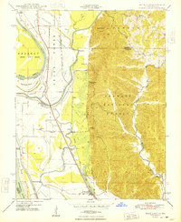
1948 Map of Wolf Lake
USGS Topo · Published 1948About this map
The Mississippi River and its intricate floodplain dominate this 1948 survey, where the river serves as the state boundary between Missouri and Illinois. The landscape is a study in early mid-century transport and flood control, featuring extensive levee systems protecting settlements like Grand Tower and Wolf Lake from the Tower Island Chute and Big Bayou. Industry and movement are defined by the Illinois Central and Missouri Pacific railroads, which parallel the river and the Pine Hills escarpment. To the east, the rugged topography of the Shawnee National Forest rises sharply from the bottomlands, dotted with small rural landmarks like Galilee Ch and Macedonia Sch. This map documents a period before modern river channelization significantly altered these backwater systems, preserving the locations of riverfront landings like Bennett Landing and Kings Ferry.
Find a feature on this map
37 named features on this map. Tap any name to fly to it.
Don’t see what you’re looking for? This feature index may not catch every label — zoom into the map to look around manually.
Map Details
Editions of this 1948 Wolf Lake Map
2 editions found
Other maps of this area

1918 · Altenburg
USGS Topo · 1:62,500

1920 · Jonesboro
USGS Topo · 1:62,500

1922 · Cape Girardeau
USGS Topo · 1:62,500

1923 · Jonesboro
USGS Topo · 1:62,500

1924 · Cape Girardeau
USGS Topo · 1:62,500

1924 · Alto Pass
USGS Topo · 1:62,500

1925 · Altenburg
USGS Topo · 1:62,500

1947 · Jonesboro
USGS Topo · 1:62,500

1947 · Alto Pass
USGS Topo · 1:62,500

1947 · Gorham
USGS Topo · 1:24,000