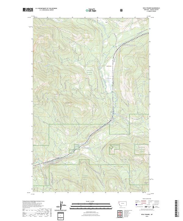
2024 Map of Wolf Prairie
USGS Topo · Published 2024About this map
Wolf Prairie sits at the heart of this landscape, surrounded by the dense timber and complex drainages of the Kootenai National Forest. The map documents a network of water systems including West Dry Fork Creek, Little Wolf Creek, and the isolated Betts Lake, all sheltered beneath the rising peaks of the Cabinet Mountains and Sugarloaf Mtn. A significant historical remnant is visible in the southern portion of the quadrangle where the Old Railroad Grade Rd follows the contours of the terrain near Kavalla Creek. This former rail line, alongside modern routes like Natl Forest Develop Road 36 Rd, highlights the long-term relationship between industrial access and these remote Montana highlands. Elevations vary from the prominent Redemption Hill to the curiously named Surprise Hill on the eastern boundary.
Find a feature on this map
31 named features on this map. Tap any name to fly to it.
Don’t see what you’re looking for? This feature index may not catch every label — zoom into the map to look around manually.
Map Details
Editions of this 2024 Wolf Prairie Map
This is the sole edition of this map. No revisions or reprints were ever made.
Other maps of this area

1920 · Jennings
USGS Topo · 1:125,000

1935 · Thompson Lakes
USGS Topo · 1:96,000

1942 · Thompson Lakes
USGS Topo · 1:125,000

1957 · Kalispell
USGS Topo · 1:250,000

1960 · Kalispell
USGS Topo · 1:250,000

1961 · Kalispell
USGS Topo · 1:250,000

1963 · Wolf Prairie
USGS Topo · 1:24,000

1963 · Warland Peak
USGS Topo · 1:24,000

1963 · Cripple Horse Mountain
USGS Topo · 1:24,000
1963 · Bowen Lake
USGS Topo · 1:24,000