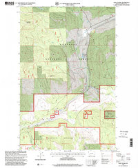
1997 Map of Wolf Prairie
USGS Topo · Published 2000About this map
French Ranch and the small settlement of Fairview sit within the timbered valleys of Kootenai National Forest in this late-twentieth-century study of Lincoln County. The landscape is defined by its complex drainage network, where Wolf Prairie Creek and Syrup Creek flow through mountain passes dominated by Sugarloaf Mountain and Redemption Hill. Industrial activity is noted by a Gravel Pit near Wolf Prairie Creek, suggesting the ongoing maintenance of the forest road system.
Find a feature on this map
15 named features on this map. Tap any name to fly to it.
Don’t see what you’re looking for? This feature index may not catch every label — zoom into the map to look around manually.
Map Details
Editions of this 1997 Wolf Prairie Map
This is the sole edition of this map. No revisions or reprints were ever made.
Other maps of this area

1920 · Jennings
USGS Topo · 1:125,000

1935 · Thompson Lakes
USGS Topo · 1:96,000

1942 · Thompson Lakes
USGS Topo · 1:125,000

1957 · Kalispell
USGS Topo · 1:250,000

1960 · Kalispell
USGS Topo · 1:250,000

1961 · Kalispell
USGS Topo · 1:250,000

1963 · Wolf Prairie
USGS Topo · 1:24,000

1963 · Warland Peak
USGS Topo · 1:24,000

1963 · Cripple Horse Mountain
USGS Topo · 1:24,000
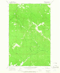
1963 · Bowen Lake
USGS Topo · 1:24,000