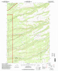
1996 Map of Wolf Run
USGS Topo · Published 1998About this map
Pleasant Ridge and the dramatic canyons of the Mount Hood National Forest define this 1990s landscape in Wasco County. The map documents a complex system of water management and drainage, with Eightmile Creek, Fifteenmile Creek, and Wolf Run carving deep paths through the terrain. A notable insight into local infrastructure is provided by the presence of the Wolf Ditch and the Dufur City Reservoir, highlighting the vital role of water sourcing for the region's agricultural and municipal needs. Small-scale settlement patterns are visible at Jewel and Taylorville, while the Wolf Run Community Hall serves as a localized landmark. The area's transition between managed forest and watershed units is clearly delineated, including The Dalles Watershed Management Unit, showing how the land was partitioned for conservation and utility during this era.
Find a feature on this map
28 named features on this map. Tap any name to fly to it.
Don’t see what you’re looking for? This feature index may not catch every label — zoom into the map to look around manually.
Map Details
Editions of this 1996 Wolf Run Map
This is the sole edition of this map. No revisions or reprints were ever made.
Other maps of this area

1930 · Dufur
USGS Topo · 1:125,000

1934 · Dufur
USGS Topo · 1:125,000

1934 · The Dalles
USGS Topo · 1:125,000

1953 · The Dalles
USGS Topo · 1:250,000

1956 · The Dalles
USGS Topo · 1:250,000

1957 · The Dalles
USGS Topo · 1:250,000

1957 · The Dalles
USGS Topo · 1:62,500

1957 · White Salmon
USGS Topo · 1:62,500

1962 · Wolf Run
USGS Topo · 1:24,000

1962 · Postage Stamp Butte
USGS Topo · 1:24,000