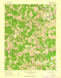
1960 Map of Wolf Summit
USGS Topo · Published 1962About this map
The Baltimore and Ohio railroad corridor anchors the landscape of central Harrison County, winding through the valley at Wolf Summit and continuing toward Wilsonburg. This 1960 survey illustrates a region defined by its narrow valley settlements and extensive coal extraction infrastructure, visible in the numerous Strip Mine operations and a prominent Mine Dump to the north. These industrial sites are interspersed with symbols of rural community life, such as the Tenmile Community Center and multiple family-named landmarks like Reynolds Cem and Hardman Cem.
Find a feature on this map
69 named features on this map. Tap any name to fly to it.
Don’t see what you’re looking for? This feature index may not catch every label — zoom into the map to look around manually.
Map Details
Editions of this 1960 Wolf Summit Map
2 editions found
Other maps of this area

1902 · Clarksburg
USGS Topo · 1:62,500

1904 · Weston
USGS Topo · 1:62,500

1904 · Vadis
USGS Topo · 1:62,500

1905 · Centerpoint
USGS Topo · 1:62,500

1910 · Clarksburg
USGS Topo · 1:62,500

1923 · Clarksburg
USGS Topo · 1:62,500

1924 · Centerpoint
USGS Topo · 1:62,500

1925 · Clarksburg
USGS Topo · 1:62,500

1925 · Centerpoint
USGS Topo · 1:62,500

1925 · Vadis
USGS Topo · 1:62,500