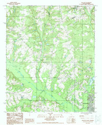
1988 Map of Wolfton
USGS Topo · Published 1988About this map
The North Fork Edisto River carves a winding path through this South Carolina landscape, defining the topography between the small settlement of Wolfton and the northwestern outskirts of Orangeburg. The area is characterized by an intricate network of waterways and wetlands, notably the Caw Caw Swamp and the convergence of Limestone Creek with its smaller tributaries. The presence of multiple Cem labels throughout the rural sections provides valuable points of interest for genealogists tracing family roots in this corner of the state.
Find a feature on this map
19 named features on this map. Tap any name to fly to it.
Don’t see what you’re looking for? This feature index may not catch every label — zoom into the map to look around manually.
Map Details
Editions of this 1988 Wolfton Map
This is the sole edition of this map. No revisions or reprints were ever made.
Other maps of this area

1919 · Bamberg
USGS Topo · 1:48,000

1920 · Bamberg
USGS Topo · 1:62,500

1920 · Orangeburg
USGS Topo · 1:48,000

1921 · Orangeburg
USGS Topo · 1:62,500

1943 · Bamberg
USGS Topo · 1:62,500

1943 · Orangeburg
USGS Topo · 1:125,000

1943 · Orangeburg
USGS Topo · 1:62,500

1946 · Woodford
USGS Topo · 1:62,500

1946 · St. Matthews
USGS Topo · 1:62,500

1954 · Augusta
USGS Topo · 1:250,000