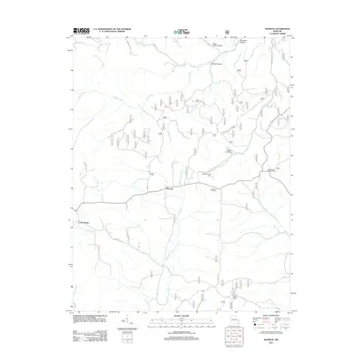
2011 Map of Womack
USGS Topo · Published 2011About this map
Womack serves as the central settlement in this portion of the Ozark foothills, where the Upper Castor River and numerous creeks carve through the landscape. The area is defined by a network of drainage systems and hollows, such as Sugar Camp Hollow and Opossum Hollow, illustrating the complex hydrology of the region before these waters join larger river systems. Local history and genealogy researchers will find the McDowell Cemetery positioned near the center of the sheet, a significant landmark for tracing early residents of Ste. Genevieve County.
Find a feature on this map
35 named features on this map. Tap any name to fly to it.
Don’t see what you’re looking for? This feature index may not catch every label — zoom into the map to look around manually.
Map Details
Editions of this 2011 Womack Map
This is the sole edition of this map. No revisions or reprints were ever made.
Other maps of this area

1904 · Farmington
USGS Topo · 1:62,500

1906 · Farmington
USGS Topo · 1:62,500

1907 · Weingarten
USGS Topo · 1:62,500

1909 · Weingarten
USGS Topo · 1:62,500

1910 · Higdon
USGS Topo · 1:62,500

1939 · Fredericktown
USGS Topo · 1:48,000

1947 · Fredericktown
USGS Topo · 1:62,500

1949 · Rolla
USGS Topo · 1:250,000

1950 · Fredericktown
USGS Topo · 1:62,500

1953 · Rolla
USGS Topo · 1:250,000