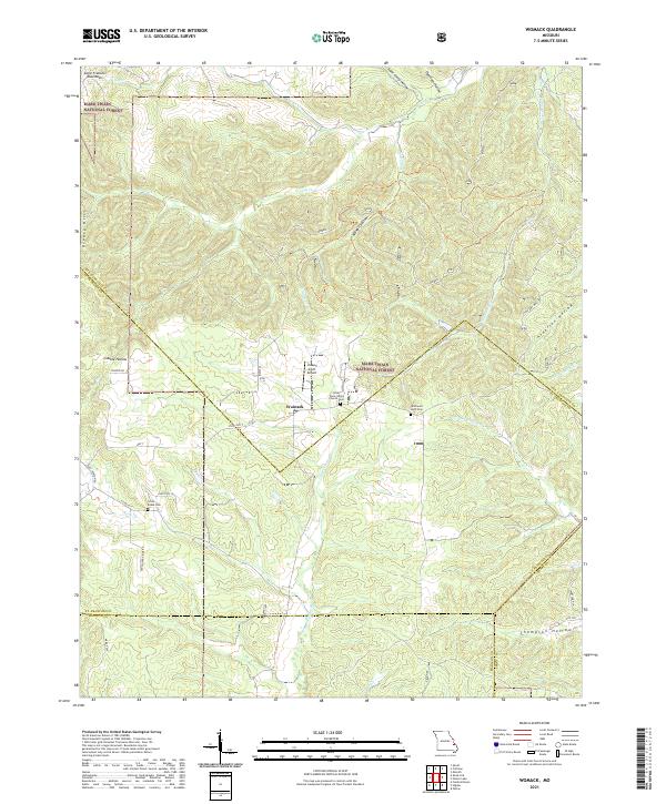
2021 Map of Womack
USGS Topo · Published 2021About this map
The eastern edges of the Saint Francois Mountains define this section of Missouri, where the headwaters of the Upper Castor River and Saline Cr begin their descent through the Greasy Hills. Located at the convergence of several county lines, the settlement of Womack serves as a central point for a landscape deeply etched by hollows like Bidwell Hollow and Gobble Hollow. Much of the terrain is protected within the Mark Twain National Forest, preserving the original drainage patterns of Greasy Cr and Upper Whitewater Cr.
Find a feature on this map
44 named features on this map. Tap any name to fly to it.
Don’t see what you’re looking for? This feature index may not catch every label — zoom into the map to look around manually.
Map Details
Editions of this 2021 Womack Map
This is the sole edition of this map. No revisions or reprints were ever made.
Other maps of this area

1904 · Farmington
USGS Topo · 1:62,500

1906 · Farmington
USGS Topo · 1:62,500

1907 · Weingarten
USGS Topo · 1:62,500

1909 · Weingarten
USGS Topo · 1:62,500

1910 · Higdon
USGS Topo · 1:62,500

1939 · Fredericktown
USGS Topo · 1:48,000

1947 · Fredericktown
USGS Topo · 1:62,500

1949 · Rolla
USGS Topo · 1:250,000

1950 · Fredericktown
USGS Topo · 1:62,500

1953 · Rolla
USGS Topo · 1:250,000