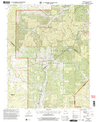
2000 Map of Womack
USGS Topo · Published 2003About this map
Womack serves as the central hub of this Missouri landscape, situated where the wooded highlands of the Mark Twain National Forest meet a complex network of river headwaters. The topography is defined by the carved paths of the Castor River, Whitewater River, and Saline Creek, alongside several family-named drainages like Thompson Hollow and Anderson Hollow. Local life and community history are anchored by the Silver Point Ch and the McDowell Cem, while the John J. Audubon Trail and Martin Road trace the ridges and valleys. A rare administrative convergence occurs here, as the map records the meeting point of four counties: Ste. Genevieve, St. Francois, Perry, and Madison. This confluence of boundaries highlights the area's significance as a geographic corner where diverse local jurisdictions and forest lands overlap.
Find a feature on this map
24 named features on this map. Tap any name to fly to it.
Don’t see what you’re looking for? This feature index may not catch every label — zoom into the map to look around manually.
Map Details
Editions of this 2000 Womack Map
This is the sole edition of this map. No revisions or reprints were ever made.
Other maps of this area

1904 · Farmington
USGS Topo · 1:62,500

1906 · Farmington
USGS Topo · 1:62,500

1907 · Weingarten
USGS Topo · 1:62,500

1909 · Weingarten
USGS Topo · 1:62,500

1910 · Higdon
USGS Topo · 1:62,500

1939 · Fredericktown
USGS Topo · 1:48,000

1947 · Fredericktown
USGS Topo · 1:62,500

1949 · Rolla
USGS Topo · 1:250,000

1950 · Fredericktown
USGS Topo · 1:62,500

1953 · Rolla
USGS Topo · 1:250,000