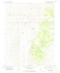
1972 Map of Wonder Mountain
USGS Topo · Published 1975About this map
The Clan Alpine Mountains define this high-desert mining landscape in Churchill County, showing a network of historic silver-mining sites that were largely inactive by the early 1970s. The topographic data captures the remnants of the boom era, specifically the Wonder (Site) and its associated Wonder Mine, alongside a sprawling area of Tailings. Further north, the townsite of Hercules (Site) sits at the mouth of Hercules Canyon, while Victor (Site) is located near Dickey Peak. These labels indicate once-thriving camps that served the district's precious metal deposits.
Find a feature on this map
28 named features on this map. Tap any name to fly to it.
Don’t see what you’re looking for? This feature index may not catch every label — zoom into the map to look around manually.
Map Details
Editions of this 1972 Wonder Mountain Map
3 editions found
Other maps of this area

1908 · Carson Sink
USGS Topo · 1:250,000

1910 · Carson Sink
USGS Topo · 1:250,000

1955 · Millett
USGS Topo · 1:250,000

1957 · Reno
USGS Topo · 1:250,000

1959 · Reno
USGS Topo · 1:250,000

1959 · Millett
USGS Topo · 1:250,000

1960 · Reno
USGS Topo · 1:250,000

1966 · Clan Alpine Ranch
USGS Topo · 1:62,500

1969 · Camp Creek Canyon
USGS Topo · 1:24,000

1969 · Eastgate
USGS Topo · 1:24,000