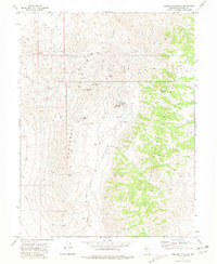
1972 Map of Wonder Mountain
USGS Topo · Published 1981About this map
Wonder (Site) and the neighboring remnants of Hercules (Site) anchor this 1970s survey of Churchill County's high desert mining country. The landscape is defined by the steep elevation changes between the Louderback Mountains and the Clan Alpine Mountains, with the prominent Wonder Mountain and Driscoll Peak rising above the terrain. This period in the early 1970s shows the region's industrial legacy through the Wonder Mine, extensive Tailings, and several mining camps marked as sites rather than active settlements. Small historical details are preserved, including a Cem located near the Wonder townsite and the Jeep Trail winding through Geiger Gap. The topography illustrates the drainage patterns from Red Top Gulch toward Badger Flat, providing a detailed look at the water-carved geography of Wonder Wash before modern environmental shifts.
Find a feature on this map
23 named features on this map. Tap any name to fly to it.
Don’t see what you’re looking for? This feature index may not catch every label — zoom into the map to look around manually.
Map Details
Editions of this 1972 Wonder Mountain Map
3 editions found
Other maps of this area

1908 · Carson Sink
USGS Topo · 1:250,000

1910 · Carson Sink
USGS Topo · 1:250,000

1955 · Millett
USGS Topo · 1:250,000

1957 · Reno
USGS Topo · 1:250,000

1959 · Reno
USGS Topo · 1:250,000

1959 · Millett
USGS Topo · 1:250,000

1960 · Reno
USGS Topo · 1:250,000

1966 · Clan Alpine Ranch
USGS Topo · 1:62,500

1969 · Camp Creek Canyon
USGS Topo · 1:24,000

1969 · Eastgate
USGS Topo · 1:24,000