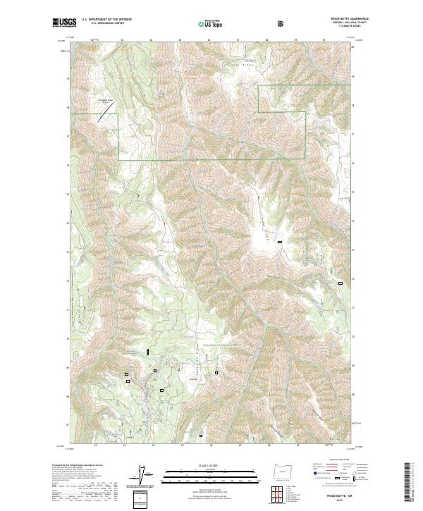
2023 Map of Wood Butte
USGS Topo · Published 2023About this map
Wallowa National Forest defines the southern expanse of this northern Oregon landscape, where the namesake Wood Butte rises above a complex system of ridges and drainage basins. The terrain is characterized by long, finger-like landforms including Powwatka Ridge, Kuhn Ridge, and McAllister Ridge, which are separated by deeply incised watercourses like Rattlesnake Creek and Mud Creek. This area illustrates the typical topographical pattern of the Blue Mountains province, where high plateaus are dissected by an intricate network of creeks flowing into the larger canyon systems.
Find a feature on this map
27 named features on this map. Tap any name to fly to it.
Don’t see what you’re looking for? This feature index may not catch every label — zoom into the map to look around manually.
Map Details
Editions of this 2023 Wood Butte Map
This is the sole edition of this map. No revisions or reprints were ever made.
Other maps of this area

1955 · Grangeville
USGS Topo · 1:250,000

1957 · Sled Springs
USGS Topo · 1:62,500

1959 · Grangeville
USGS Topo · 1:250,000

1964 · Akers Butte
USGS Topo · 1:24,000

1967 · Wood Butte
USGS Topo · 1:24,000

1967 · Troy
USGS Topo · 1:24,000

1967 · Eden
USGS Topo · 1:24,000
1967 · Shamrock Creek
USGS Topo · 1:24,000

1967 · Promise
USGS Topo · 1:24,000
1967 · Flora
USGS Topo · 1:24,000