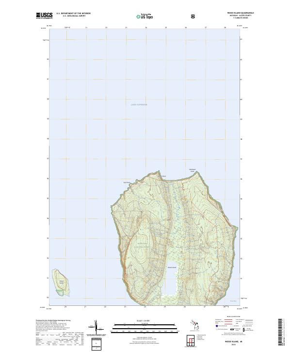
2023 Map of Wood Island
USGS Topo · Published 2023About this map
Hiawatha National Forest encompasses the significant landmass of Grand Island on this recent survey of the Alger County shoreline. The island is defined by its recreation-focused geography, featuring a network of trails such as the Grand Island Bike Trl and the specialized Grand Island Hike-only East Trl that circumnavigates the eastern cliffs. The map reveals a landform shaped by northern exposure to Lake Superior, terminating in prominent features like North Point and Northeast Point.
Find a feature on this map
14 named features on this map. Tap any name to fly to it.
Don’t see what you’re looking for? This feature index may not catch every label — zoom into the map to look around manually.
Map Details
Editions of this 2023 Wood Island Map
This is the sole edition of this map. No revisions or reprints were ever made.
Other maps of this area

1958 · Munising
USGS Topo · 1:62,500

1958 · Au Train
USGS Topo · 1:62,500

1958 · Wood Island
USGS Topo · 1:62,500

1958 · Marquette
USGS Topo · 1:250,000

1960 · Marquette
USGS Topo · 1:250,000

1961 · Marquette
USGS Topo · 1:250,000

1968 · Marquette
USGS Topo · 1:250,000

1983 · Munising
USGS Topo · 1:100,000
1984 · Au Sable Point
USGS Topo · 1:100,000
1984 · Wood Island SE
USGS Topo · 1:24,000