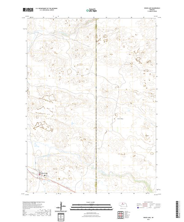
2021 Map of Wood Lake
USGS Topo · Published 2021About this map
Wood Lake sits at the southwestern edge of this landscape, marking a localized hub of activity in the Nebraska Sandhills. The settlement is anchored by a small grid of streets including Lake St and Main St, with the Mount Hope Cem situated on the eastern outskirts. This rural interior is defined by a complex drainage system that includes S-Fork Fairfield Cr to the north and the eastward-flowing Evergreen Cr and Dry Cr further south. The topography is dominated by Porter Valley, where the landforms reflect the distinct geomorphology of the Cherry County and Brown County border. A significant modern recreational feature, the Cowboy Trl, cuts across the lower portion of the map, following a former rail alignment that once served the remote ranching communities of this region.
Find a feature on this map
14 named features on this map. Tap any name to fly to it.
Don’t see what you’re looking for? This feature index may not catch every label — zoom into the map to look around manually.
Map Details
Editions of this 2021 Wood Lake Map
This is the sole edition of this map. No revisions or reprints were ever made.
Other maps of this area

1950 · Norden
USGS Topo · 1:62,500

1950 · Sparks
USGS Topo · 1:62,500

1950 · Wood Lake
USGS Topo · 1:62,500

1950 · Arabia
USGS Topo · 1:62,500

1952 · Norden
USGS Topo · 1:62,500

1957 · Valentine
USGS Topo · 1:250,000

1959 · Valentine
USGS Topo · 1:250,000
1983 · Norden
USGS Topo · 1:24,000
1983 · Muleshoe Creek
USGS Topo · 1:24,000
1983 · Sparks SE
USGS Topo · 1:24,000