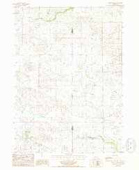
1985 Map of Wood Lake
USGS Topo · Published 1985About this map
Wood Lake anchors the southwestern corner of this survey, a small settlement located on the edge of the Nebraska Sandhills. The landscape is dominated by the complex drainage patterns of Evergreen Creek and the South Fork Fairfield Creek, which carve through the undulating terrain near the border of Cherry and Brown Counties. The presence of several irrigation features, labeled as IRR Wells, indicates the vital role of groundwater management in this ranching country during the 1980s. Local history is anchored at the Mt Hope Cem, situated just east of the main townsite. The map also traces more ephemeral watercourses like Minnie Cr and the broad depressions of Porter Valley, illustrating the subtle topographic shifts that define the Nebraska plains.
Find a feature on this map
9 named features on this map. Tap any name to fly to it.
Don’t see what you’re looking for? This feature index may not catch every label — zoom into the map to look around manually.
Map Details
Editions of this 1985 Wood Lake Map
This is the sole edition of this map. No revisions or reprints were ever made.
Other maps of this area

1950 · Norden
USGS Topo · 1:62,500

1950 · Sparks
USGS Topo · 1:62,500

1950 · Wood Lake
USGS Topo · 1:62,500

1950 · Arabia
USGS Topo · 1:62,500

1952 · Norden
USGS Topo · 1:62,500

1957 · Valentine
USGS Topo · 1:250,000

1959 · Valentine
USGS Topo · 1:250,000
1983 · Norden
USGS Topo · 1:24,000
1983 · Muleshoe Creek
USGS Topo · 1:24,000
1983 · Sparks SE
USGS Topo · 1:24,000