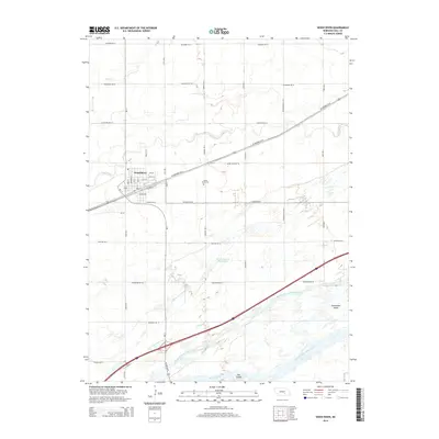
2014 Map of Wood River
USGS Topo · Published 2014About this map
The settlement of Wood River is the central hub of this Hall County survey, situated where the US Highway 30 W and the railroad corridor converge. The town's grid is clearly defined by local landmarks like Wood River Cem and various residential streets such as Oak St and Main St. Outside the town center, the landscape is dominated by the complex hydrology of the Platte River valley, where the river splits into multiple distinct branches, including the North Channel Platte River, Middle Channel Platte River, and South Channel Platte River. These braided channels create large landforms such as Shoemaker Island and Elm Island, illustrating the river's historical influence on local geography and property boundaries. North of the town, smaller watercourses like Silver Cr wind through a landscape organized by a rigorous section-line road network.
Find a feature on this map
40 named features on this map. Tap any name to fly to it.
Don’t see what you’re looking for? This feature index may not catch every label — zoom into the map to look around manually.
Map Details
Editions of this 2014 Wood River Map
This is the sole edition of this map. No revisions or reprints were ever made.
Other maps of this area

1892 · Grand Island
USGS Topo · 1:62,500

1894 · Kenesaw
USGS Topo · 1:62,500

1895 · Grand Island
USGS Topo · 1:62,500

1895 · Wood River
USGS Topo · 1:62,500

1896 · Wood River
USGS Topo · 1:125,000

1898 · Grand Island
USGS Topo · 1:125,000

1955 · Grand Island
USGS Topo · 1:250,000

1957 · Grand Island
USGS Topo · 1:250,000

1958 · Grand Island
USGS Topo · 1:250,000

1962 · Denman
USGS Topo · 1:24,000