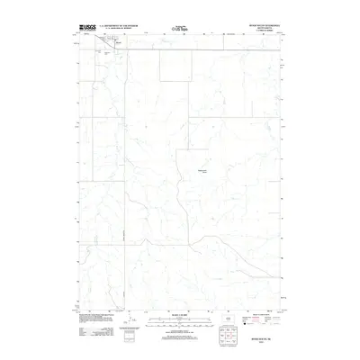
2012 Map of Wood South
USGS Topo · Published 2012About this map
Wood stands at the northern edge of this high-plains landscape, serving as a focal point for the surrounding Mellette County prairie. The town layout is clearly defined along Main St, situated just south of the winding course of Butte Cr. Community landmarks such as the Grandstand Rodeo Arena reflect the local cultural heritage, while the presence of Evergreen Cem and Mediator Cem offers vital spatial data for genealogical research in this sparsely settled region. The terrain is characterized by the vast drainage network of Butte Cr, which meanders across the quadrangle toward the south. Prominent landforms like Rattlesnake Butte anchor the horizon, providing natural navigational markers. A network of rural arteries, including Hidden Timber Rd and Wood Rd, connects remote ranchlands to the settlement, illustrating the enduring transport patterns of South Dakota's interior.
Find a feature on this map
9 named features on this map. Tap any name to fly to it.
Don’t see what you’re looking for? This feature index may not catch every label — zoom into the map to look around manually.
Map Details
Editions of this 2012 Wood South Map
This is the sole edition of this map. No revisions or reprints were ever made.
Other maps of this area

1955 · Martin
USGS Topo · 1:250,000

1958 · Martin
USGS Topo · 1:250,000

1982 · Mission NE
USGS Topo · 1:24,000

1982 · White River SE
USGS Topo · 1:24,000

1982 · Wood North
USGS Topo · 1:24,000

1982 · Badnation SE
USGS Topo · 1:25,000

1982 · Okreek
USGS Topo · 1:25,000

1982 · Okreek SE
USGS Topo · 1:24,000
1982 · Mission SE
USGS Topo · 1:24,000

1982 · Mosher
USGS Topo · 1:25,000