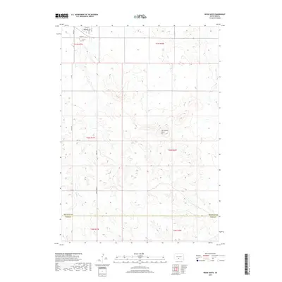
2017 Map of Wood South
USGS Topo · Published 2017About this map
Wood sits at the northern edge of this landscape, serving as a gateway to the high plains where Mellette and Todd counties meet. The terrain is defined by the sharp relief of Rattlesnake Butte and the drainage of Butte Creek, which winds through the southern reaches of the quadrangle. Local heritage is concentrated around the town's core, marked by the presence of Evergreen Cemetery and Mediator Cemetery. The road network, including Hidden Timber Road and 282nd Avenue, provides the primary structure for this agricultural region, tracing the section lines that organize the prairie into a distinct grid. This survey captures the rural character of south-central South Dakota, where the transition from town streets like Main St to open range occurs within just a few miles.
Find a feature on this map
23 named features on this map. Tap any name to fly to it.
Don’t see what you’re looking for? This feature index may not catch every label — zoom into the map to look around manually.
Map Details
Editions of this 2017 Wood South Map
This is the sole edition of this map. No revisions or reprints were ever made.
Other maps of this area

1955 · Martin
USGS Topo · 1:250,000

1958 · Martin
USGS Topo · 1:250,000

1982 · Mission NE
USGS Topo · 1:24,000

1982 · White River SE
USGS Topo · 1:24,000

1982 · Wood North
USGS Topo · 1:24,000

1982 · Badnation SE
USGS Topo · 1:25,000

1982 · Okreek
USGS Topo · 1:25,000

1982 · Okreek SE
USGS Topo · 1:24,000
1982 · Mission SE
USGS Topo · 1:24,000

1982 · Mosher
USGS Topo · 1:25,000