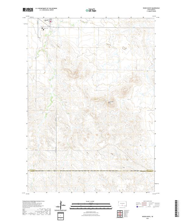
2021 Map of Wood South
USGS Topo · Published 2021About this map
The town of Wood anchors the northern edge of this landscape, situated just above the Evergreen Cem and Mediator Cem. The topography is defined by the winding course of Butte Cr, which carves through the prairie south toward the border between Mellette County and Todd County. This area of south-central South Dakota transitions from the organized grid of the township into more varied terrain marked by prominent landmarks like Rattlesnake Butte. The network of local roads, such as Hidden Timber Rd and 282nd Ave, provides a clear view of the rural infrastructure connecting the scattered homesteads and ranches that characterize this part of the Rosebud region. The map preserves the specific placement of local institutions and geographic features that define the character of the community at the start of the 2020s.
Find a feature on this map
22 named features on this map. Tap any name to fly to it.
Don’t see what you’re looking for? This feature index may not catch every label — zoom into the map to look around manually.
Map Details
Editions of this 2021 Wood South Map
This is the sole edition of this map. No revisions or reprints were ever made.
Other maps of this area

1955 · Martin
USGS Topo · 1:250,000

1958 · Martin
USGS Topo · 1:250,000

1982 · Mission NE
USGS Topo · 1:24,000

1982 · White River SE
USGS Topo · 1:24,000

1982 · Wood North
USGS Topo · 1:24,000

1982 · Badnation SE
USGS Topo · 1:25,000

1982 · Okreek
USGS Topo · 1:25,000

1982 · Okreek SE
USGS Topo · 1:24,000
1982 · Mission SE
USGS Topo · 1:24,000

1982 · Mosher
USGS Topo · 1:25,000