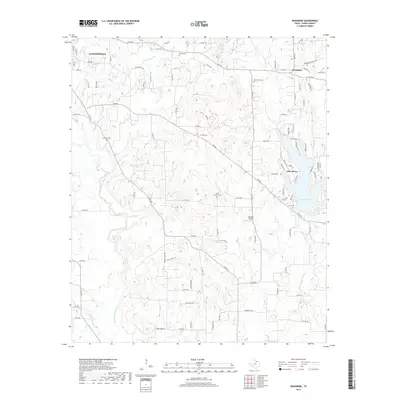
2019 Map of Woodbine
USGS Topo · Published 2019About this map
The Elm Fork Trinity River winds through the rural landscape of eastern Cooke County, shaping the terrain between the growing city of Gainesville and the residential community of Lake Kiowa. This document illustrates a transition from the structured streets of Gainesville, marked by Harris St and Moss St, to the winding lanes of Woodbine and the sprawling waterfront developments surrounding the lake. The presence of numerous family and community burial sites, such as Dervin Cem, Oak Grove Cem, and Redmond Cem, provides valuable points of reference for genealogists tracing local lineage in this part of North Texas. Small tributaries like Wolf Cr and Pecan Cr further define the drainage patterns of the region, while Robotek Airport stands as a notable landmark in the central rural corridor.
Find a feature on this map
63 named features on this map. Tap any name to fly to it.
Don’t see what you’re looking for? This feature index may not catch every label — zoom into the map to look around manually.
Map Details
Editions of this 2019 Woodbine Map
This is the sole edition of this map. No revisions or reprints were ever made.
Other maps of this area

1901 · Denison
USGS Topo · 1:125,000

1902 · Gainesville
USGS Topo · 1:125,000

1943 · Gainesville
USGS Topo · 1:125,000

1954 · Sherman
USGS Topo · 1:250,000

1958 · Whitesboro
USGS Topo · 1:62,500

1958 · Sherman
USGS Topo · 1:250,000

1960 · Callisburg
USGS Topo · 1:24,000

1960 · Gainesville South
USGS Topo · 1:24,000

1960 · Gainesville North
USGS Topo · 1:24,000

1960 · Woodbine
USGS Topo · 1:24,000