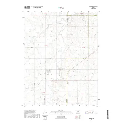
2018 Map of Woodbine
USGS Topo · Published 2018About this map
Woodbine and the surrounding rural plains of Dickinson and Morris counties are defined by the winding course of Lyon Creek and its many tributaries. This 2018 survey details the transition from the structured grid of town streets, such as 5th St and Gillette Ave, to the expansive agricultural landscape marked by a network of sectional roads. The map highlights key communal sites like the Woodbine Cem and the northern settlement of Lyona, where the Lyona Cem remains a significant local landmark. The drainage patterns of Carry Cr and the W Br Lyon Cr illustrate the natural hydrology that has shaped farming and settlement in this portion of Kansas for generations. From the intersection of Union Rd and 1400 Ave to the remote eastern stretches near Zinc Rd, the map provides a comprehensive view of the modern rural infrastructure.
Find a feature on this map
43 named features on this map. Tap any name to fly to it.
Don’t see what you’re looking for? This feature index may not catch every label — zoom into the map to look around manually.
Map Details
Editions of this 2018 Woodbine Map
This is the sole edition of this map. No revisions or reprints were ever made.
Other maps of this area

1889 · Abilene
USGS Topo · 1:125,000

1889 · Parkerville
USGS Topo · 1:125,000

1894 · Abilene
USGS Topo · 1:125,000

1894 · Parkerville
USGS Topo · 1:125,000

1955 · Hutchinson
USGS Topo · 1:250,000

1959 · Hutchinson
USGS Topo · 1:250,000
1964 · Chapman
USGS Topo · 1:24,000

1964 · Navarre
USGS Topo · 1:24,000

1964 · Skiddy
USGS Topo · 1:24,000
1964 · Kansas Falls
USGS Topo · 1:24,000