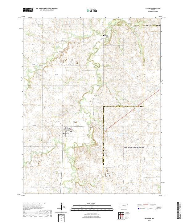
2022 Map of Woodbine
USGS Topo · Published 2022About this map
Lyon Creek and its tributary Carry Cr wind through this rural Kansas landscape, where the borders of Dickinson, Geary, and Morris counties meet. The small settlement of Woodbine serves as a local hub, defined by its grid of streets including 5th St and 6th St, and the nearby Woodbine Cem. To the north, the community of Lyona remains a focal point for local history, centered on the Lyona Methodist Church and its adjacent Church Cem. The terrain is characterized by a network of sectional roads like Trail Rd, Union Rd, and Wolf Rd that follow the natural topography of the creek valleys. This map captures the enduring agricultural character of the region, where family homesteads are connected by a precise grid of avenues such as 1900 Ave and 1100 Ave, marking generations of land use in the heart of the Flint Hills region.
Find a feature on this map
45 named features on this map. Tap any name to fly to it.
Don’t see what you’re looking for? This feature index may not catch every label — zoom into the map to look around manually.
Map Details
Editions of this 2022 Woodbine Map
This is the sole edition of this map. No revisions or reprints were ever made.
Other maps of this area

1889 · Abilene
USGS Topo · 1:125,000

1889 · Parkerville
USGS Topo · 1:125,000

1894 · Abilene
USGS Topo · 1:125,000

1894 · Parkerville
USGS Topo · 1:125,000

1955 · Hutchinson
USGS Topo · 1:250,000

1959 · Hutchinson
USGS Topo · 1:250,000
1964 · Chapman
USGS Topo · 1:24,000

1964 · Navarre
USGS Topo · 1:24,000

1964 · Skiddy
USGS Topo · 1:24,000
1964 · Kansas Falls
USGS Topo · 1:24,000