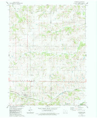
1983 Map of Woodburn
USGS Topo · Published 1984About this map
Woodburn and Ottawa anchor this rural landscape in the early 1980s, where the topography is defined by the winding drainages of Otter Creek and Brush Creek. The southern portion of the area shows the influence of the Burlington Northern railroad, which runs parallel to the creek through Woodburn. Significant for genealogists and local historians, the sheet identifies several family and community burial grounds including Harrison Cem, Walker Cem, Ottawa Cem, St Marys Cem, and the uniquely named Water Tank Cem. The southeastern corner transitions into the protected timber of Stephens State Forest near White Breast Creek. The distribution of these landmarks reflects a typical Midwestern agricultural pattern, with small settlements and rural cemeteries dispersed across the rolling divides between the many named tributaries like Victory Creek and South Otter Creek.
Find a feature on this map
19 named features on this map. Tap any name to fly to it.
Don’t see what you’re looking for? This feature index may not catch every label — zoom into the map to look around manually.
Map Details
Editions of this 1983 Woodburn Map
This is the sole edition of this map. No revisions or reprints were ever made.
Other maps of this area

1918 · Chariton
USGS Topo · 1:62,500

1934 · Humeston
USGS Topo · 1:48,000

1937 · Corydon
USGS Topo · 1:62,500

1950 · New Virginia
USGS Topo · 1:62,500

1952 · New Virginia
USGS Topo · 1:62,500

1954 · Centerville
USGS Topo · 1:250,000

1954 · Des Moines
USGS Topo · 1:250,000

1956 · Des Moines
USGS Topo · 1:250,000

1957 · Des Moines
USGS Topo · 1:250,000

1957 · Centerville
USGS Topo · 1:250,000