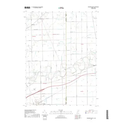
2019 Map of Woodburn North
USGS Topo · Published 2019About this map
The Maumee River winds prominently through this borderland region, cutting a wide path between Antwerp and Woodburn as it crosses from Indiana into Ohio. This agricultural landscape is defined by an intricate network of drainage ditches—including Wann Ditch, Hamm Ditch, and Beerbower Ditch—that supported the conversion of the Great Black Swamp into productive farmland. Small community markers like Halls Corners and Georgetown are scattered across the grid of section lines, reflecting the durable settlement patterns established during the late nineteenth century. Genealogical researchers can locate several family and community burial grounds, such as Scipio Cem and Diehl Cem, while landmarks like Brenneke Airport and Bluecast Spring show the ongoing use of the area's flat terrain and natural resources in the modern era.
Find a feature on this map
86 named features on this map. Tap any name to fly to it.
Don’t see what you’re looking for? This feature index may not catch every label — zoom into the map to look around manually.
Map Details
Editions of this 2019 Woodburn North Map
This is the sole edition of this map. No revisions or reprints were ever made.
Other maps of this area

1914 · Bryan
USGS Topo · 1:62,500

1914 · Paulding
USGS Topo · 1:62,500

1943 · Bryan
USGS Topo · 1:62,500

1944 · Paulding
USGS Topo · 1:62,500

1953 · Fort Wayne
USGS Topo · 1:250,000

1956 · Fort Wayne
USGS Topo · 1:250,000

1957 · Maples
USGS Topo · 1:24,000

1958 · Hicksville
USGS Topo · 1:24,000

1958 · Grabill
USGS Topo · 1:24,000

1958 · Woodburn North
USGS Topo · 1:24,000