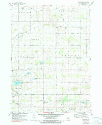
1978 Map of Woodbury
USGS Topo · Published 1979About this map
Agricultural fields and scattered woodlots define the landscape of this rural Michigan borderland in the late 1970s. The settlement of Woodbury sits at the intersection of the Chesapeake and Ohio railroad and the county line, while West Sebewa serves as a central hub for the township's farming community. The terrain is marked by numerous glacial depressions, forming small bodies of water like Augst Lake, Little Lake, and Mini Lake, along with the larger Tupper Lake to the southwest.
Find a feature on this map
51 named features on this map. Tap any name to fly to it.
Don’t see what you’re looking for? This feature index may not catch every label — zoom into the map to look around manually.
Map Details
Editions of this 1978 Woodbury Map
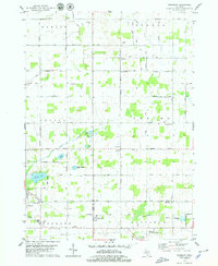
2 editions found
Other maps of this area

1916 · Ionia
USGS Topo · 1:62,500

1918 · Ionia
USGS Topo · 1:62,500

1943 · Ionia
USGS Topo · 1:62,500

1945 · Portland
USGS Topo · 1:62,500

1949 · Charlotte
USGS Topo · 1:62,500

1950 · Nashville
USGS Topo · 1:62,500

1951 · Nashville
USGS Topo · 1:62,500

1958 · Grand Rapids
USGS Topo · 1:250,000

1961 · Grand Rapids
USGS Topo · 1:250,000

1962 · Grand Rapids
USGS Topo · 1:250,000