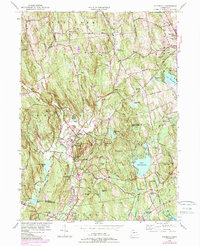
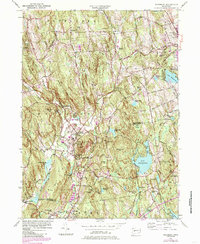
1955 Map of Woodbury
USGS Topo · Published 1985About this map
Woodbury and its surrounding hill country are defined by a network of river valleys, where the Pomperaug River, Weekeepeemee River, and Nonewaug River converge. This 1955 survey, updated with 1980s urban expansion data, shows the traditional village centers of North Woodbury and Hotchkissville maintaining their distinct character amidst the rising terrain of the Orenaug Hills and Caleb Hill. The landscape is a mix of long-established institutional footprints, such as the Regina Laudis Priory and Taft Sch, alongside significant water bodies like Lake Quassapaug and Lake Winnemaug. Genealogists will find numerous burial grounds preserved across the landscape, including Evergreen Cem and Mt Olivet Cem. The map captures a moment of transition as postwar growth began to touch the rural edges of Watertown and Middlebury, marked by the introduction of newer residential street patterns near the older agricultural landmarks of Rag Land and Bear Hill.
Find a feature on this map
97 named features on this map. Tap any name to fly to it.
Don’t see what you’re looking for? This feature index may not catch every label — zoom into the map to look around manually.
Map Details
Editions of this 1955 Woodbury Map
5 editions found
Other maps of this area

1889 · Derby
USGS Topo · 1:62,500

1891 · Derby
USGS Topo · 1:62,500

1892 · Danbury
USGS Topo · 1:62,500

1892 · New Milford
USGS Topo · 1:62,500

1893 · Waterbury
USGS Topo · 1:62,500

1893 · New Milford
USGS Topo · 1:62,500

1893 · Derby
USGS Topo · 1:62,500

1904 · New Milford
USGS Topo · 1:62,500

1904 · Waterbury
USGS Topo · 1:62,500

1904 · Litchfield
USGS Topo · 1:125,000