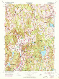
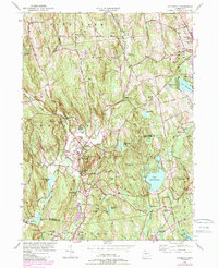
1955 Map of Woodbury
USGS Topo · Published 1972About this map
Regina Laudis Priory and the surrounding hills of Litchfield County define this landscape during a period of post-war suburban transition. The map illustrates the historic core of Woodbury and North Woodbury, where the Pomperaug River and Nonewaug River converge amidst a series of prominent peaks like Caleb Hill and the Orenaug Hills. Updated with 1970s revisions, the sheet shows the growth of residential areas around Lake Quassapaug and Lake Winnemaug, while still preserving the footprints of long-established institutions such as the Taft Sch and multiple local burying grounds including North Cem and South Cem. This cartographic record captures the Litchfield Hills just as modern highway improvements began to further connect these once-secluded rural townships to the larger regional economy.
Find a feature on this map
78 named features on this map. Tap any name to fly to it.
Don’t see what you’re looking for? This feature index may not catch every label — zoom into the map to look around manually.
Map Details
Editions of this 1955 Woodbury Map
5 editions found
Other maps of this area

1889 · Derby
USGS Topo · 1:62,500

1891 · Derby
USGS Topo · 1:62,500

1892 · Danbury
USGS Topo · 1:62,500

1892 · New Milford
USGS Topo · 1:62,500

1893 · Waterbury
USGS Topo · 1:62,500

1893 · New Milford
USGS Topo · 1:62,500

1893 · Derby
USGS Topo · 1:62,500

1904 · New Milford
USGS Topo · 1:62,500

1904 · Waterbury
USGS Topo · 1:62,500

1904 · Litchfield
USGS Topo · 1:125,000