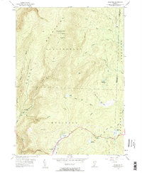
1954 Map of Woodford
USGS Topo · Published 1961About this map
The Green Mountains dominate this mid-century landscape, centered on the high peaks of Glastenbury Mtn and the town of Woodford. This survey reveals a region defined by its hiking and logging history, following the winding path of the Long Trail and the southern corridor of the Molly Stark Trail. The area is densely patterned with water features, from the high elevation of Lost Pond to the Adams Reservoir and Red Mill Pond near the town center. Local heritage is marked by established sites such as Glastenbury Camp and Fay Fuller Camp, alongside the Lookout Tower which once served as a primary observation point. The terrain transitions from the steep drainage of Bolles Brook to the broad, open Castle Meadow, illustrating the varied topography of Bennington County during the 1950s.
Find a feature on this map
40 named features on this map. Tap any name to fly to it.
Don’t see what you’re looking for? This feature index may not catch every label — zoom into the map to look around manually.
Map Details
Editions of this 1954 Woodford Map
3 editions found

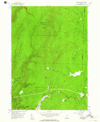
Other maps of this area

1889 · Wilmington
USGS Topo · 1:62,500

1891 · Wilmington
USGS Topo · 1:62,500

1894 · Londonderry
USGS Topo · 1:62,500

1894 · Equinox
USGS Topo · 1:62,500

1896 · Equinox
USGS Topo · 1:62,500

1898 · Bennington
USGS Topo · 1:62,500

1899 · Londonderry
USGS Topo · 1:62,500

1899 · Wilmington
USGS Topo · 1:62,500

1900 · Taconic
USGS Topo · 1:125,000

1900 · Equinox
USGS Topo · 1:62,500