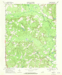
1969 Map of Woodford
USGS Topo · Published 1970About this map
The Mattaponi River and Matta River systems converge in this 1969 study of Caroline County, where the Richmond Fredericksburg and Potomac railroad corridor dictates the placement of crossroads like Woodford and Milford. The landscape is a network of timbered swamps and small drainage basins, including Hobby Swamp and Reedy Swamp, punctuated by family-named landmarks and rural institutions.
Find a feature on this map
42 named features on this map. Tap any name to fly to it.
Don’t see what you’re looking for? This feature index may not catch every label — zoom into the map to look around manually.
Map Details
Editions of this 1969 Woodford Map
3 editions found
Other maps of this area

1887 · Spottsylvania
USGS Topo · 1:125,000

1889 · Fredericksburg
USGS Topo · 1:125,000

1890 · Goochland
USGS Topo · 1:125,000

1892 · Fredericksburg
USGS Topo · 1:125,000

1892 · Spottsylvania
USGS Topo · 1:125,000

1892 · Goochland
USGS Topo · 1:125,000

1894 · Fredericksburg
USGS Topo · 1:125,000

1918 · Doswell
USGS Topo · 1:62,500

1942 · Bowling Green
USGS Topo · 1:31,680

1942 · Woodford
USGS Topo · 1:31,680