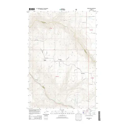
2014 Map of Woodland
USGS Topo · Published 2014About this map
Woodland and Harrisburg sit upon the high plateau country of north-central Idaho, where the land breaks sharply toward the Clearwater River and its major tributaries. This landscape is defined by its agricultural and timber history, evidenced by the namesake Schmidt Mill located in the northern reaches near Schmidt Cr. The road network reflects a history of local landownership and topographical necessity, with routes like Pucketts Corner Rd and Carrot Ridge Rd connecting family outposts.
Find a feature on this map
33 named features on this map. Tap any name to fly to it.
Don’t see what you’re looking for? This feature index may not catch every label — zoom into the map to look around manually.
Map Details
Editions of this 2014 Woodland Map
This is the sole edition of this map. No revisions or reprints were ever made.
Other maps of this area

1924 · Kamiah
USGS Topo · 1:125,000

1924 · Weippe
USGS Topo · 1:125,000

1955 · Pullman
USGS Topo · 1:250,000

1956 · Hamilton
USGS Topo · 1:250,000

1958 · Pullman
USGS Topo · 1:250,000

1959 · Hamilton
USGS Topo · 1:250,000

1960 · Hamilton
USGS Topo · 1:250,000

1964 · Hamilton
USGS Topo · 1:250,000

1966 · Kooskia
USGS Topo · 1:24,000
1966 · Weippe South
USGS Topo · 1:24,000