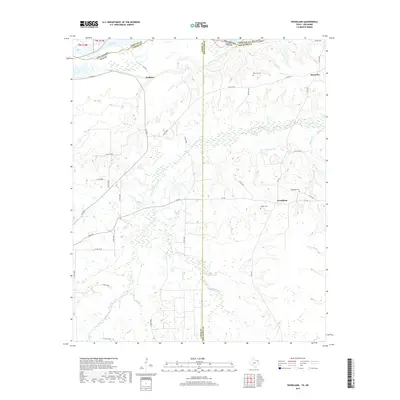
2019 Map of Woodland
USGS Topo · Published 2019About this map
The Red River forms the winding border between Texas and Oklahoma at the northern edge of this landscape, carving a path past Bowman Island. This region, where Lamar and Red River counties meet, is defined by a network of waterways including Pine Creek, Little Pine Cr, and the headwaters of Pecan Bayou. Small rural settlements like Woodland and Kanawha serve as central points for the surrounding agricultural land, connected by a web of farm-to-market roads and county routes. Genealogists will find significant local history preserved in the several burial grounds dotting the area, such as Woodland Cem, Pine Hill Cem, and Tinsley Cem. The map illustrates the persistent rural character of this borderland, where the terrain transitions from the river bottomlands into a prairie landscape punctuated by Rogers Lake and numerous seasonal wetlands.
Find a feature on this map
42 named features on this map. Tap any name to fly to it.
Don’t see what you’re looking for? This feature index may not catch every label — zoom into the map to look around manually.
Map Details
Editions of this 2019 Woodland Map
This is the sole edition of this map. No revisions or reprints were ever made.
Other maps of this area

1951 · Slate Shoals
USGS Topo · 1:24,000

1951 · Frogville
USGS Topo · 1:24,000

1951 · Shoals
USGS Topo · 1:24,000

1951 · Kiomatia
USGS Topo · 1:24,000

1951 · Woodland
USGS Topo · 1:24,000

1951 · Manchester
USGS Topo · 1:24,000

1953 · Texarkana
USGS Topo · 1:250,000

1956 · Texarkana
USGS Topo · 1:250,000

1964 · Detroit
USGS Topo · 1:24,000

1964 · Bagwell
USGS Topo · 1:24,000