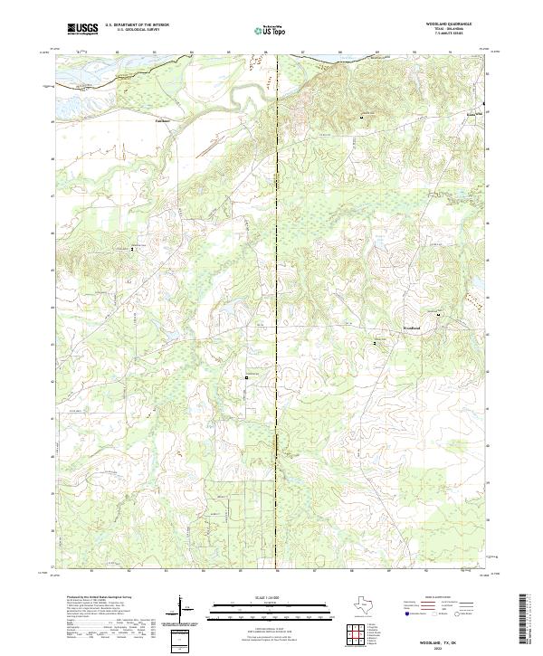
2022 Map of Woodland
USGS Topo · Published 2022About this map
Red River and its shifting northern border form the geographic anchor of this northeast Texas landscape, where the state line meets the boundary between Lamar and Red River counties. The settlement of Woodland sits central to a network of rural roads such as FM 195, surrounded by a high density of local burial grounds that reflect the area's deep genealogical roots. From Palestine Cem in the west to Woodland Cem and Tinsley Cem near the town center, these sites mark the long-standing community foundations of the region. The terrain is defined by the winding course of Pine Creek and Little Pine Cr, which drain into the river valley past Bowman Island. Further east, the small settlement of Kanawha stands near the county line, while the northern reaches near Faulkner showcase the expansive bottomlands and varied water features like Rogers Lake and Pecan Bayou.
Find a feature on this map
45 named features on this map. Tap any name to fly to it.
Don’t see what you’re looking for? This feature index may not catch every label — zoom into the map to look around manually.
Map Details
Editions of this 2022 Woodland Map
This is the sole edition of this map. No revisions or reprints were ever made.
Other maps of this area

1951 · Slate Shoals
USGS Topo · 1:24,000

1951 · Frogville
USGS Topo · 1:24,000

1951 · Shoals
USGS Topo · 1:24,000

1951 · Kiomatia
USGS Topo · 1:24,000

1951 · Woodland
USGS Topo · 1:24,000

1951 · Manchester
USGS Topo · 1:24,000

1953 · Texarkana
USGS Topo · 1:250,000

1956 · Texarkana
USGS Topo · 1:250,000

1964 · Detroit
USGS Topo · 1:24,000

1964 · Bagwell
USGS Topo · 1:24,000