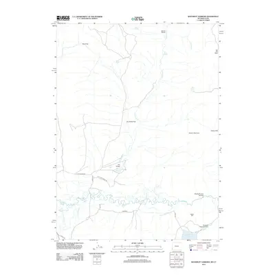
2012 Map of Woodruff Narrows
USGS Topo · Published 2012About this map
The Bear River meanders sharply across this portion of Uinta County, creating a complex hydrology of oxbows and marshy features like Live Slough. This modern topographical survey captures the high-elevation landscape as it transitions from the Session Mountains in the east toward the broad, flat expanses of Dry Hollow Flats. Water management remains a defining characteristic of the region, evidenced by the Woodruff Narrows Reservoir and the containment of the river between the Woodruff Upper Narrows and Woodruff Lower Narrows.
Find a feature on this map
27 named features on this map. Tap any name to fly to it.
Don’t see what you’re looking for? This feature index may not catch every label — zoom into the map to look around manually.
Map Details
Editions of this 2012 Woodruff Narrows Map
This is the sole edition of this map. No revisions or reprints were ever made.
Other maps of this area

1912 · Randolph
USGS Topo · 1:125,000

1954 · Ogden
USGS Topo · 1:250,000

1958 · Ogden
USGS Topo · 1:250,000

1960 · Ogden
USGS Topo · 1:250,000

1962 · Sawtooth Mountain
USGS Topo · 1:24,000

1962 · Windy Point
USGS Topo · 1:24,000

1965 · Three Forks
USGS Topo · 1:24,000

1968 · Rex Peak
USGS Topo · 1:24,000

1968 · Randolph
USGS Topo · 1:24,000

1968 · Woodruff
USGS Topo · 1:24,000