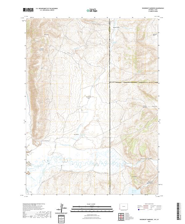
2021 Map of Woodruff Narrows
USGS Topo · Published 2021About this map
The Bear River winds through this high-altitude borderland between Utah and Wyoming, creating a complex network of water management features essential to the region's ranching history. The landscape is defined by the massive Woodruff Narrows Reservoir and the Dry Hollow Reservoir, which anchor an intricate system of irrigation including the Bear River Canal, Neville Canal, Booth Canal, and Sidehill Ditch. These man-made diversions illustrate the long-standing effort to harness the river as it passes through the Woodruff Upper Narrows and Woodruff Lower Narrows. Rising above the valley floor, the Crawford Mountains and Session Mountains dominate the skyline, punctuated by high-country transitions such as Wood Pass and Session Pass. This survey provides a clear look at the intersection of Rich, Lincoln, and Uinta counties, where springs like Gil Smith Spring and Mud Spring provide vital water points in the arid terrain.
Find a feature on this map
37 named features on this map. Tap any name to fly to it.
Don’t see what you’re looking for? This feature index may not catch every label — zoom into the map to look around manually.
Map Details
Editions of this 2021 Woodruff Narrows Map
This is the sole edition of this map. No revisions or reprints were ever made.
Other maps of this area

1912 · Randolph
USGS Topo · 1:125,000

1954 · Ogden
USGS Topo · 1:250,000

1958 · Ogden
USGS Topo · 1:250,000

1960 · Ogden
USGS Topo · 1:250,000

1962 · Sawtooth Mountain
USGS Topo · 1:24,000

1962 · Windy Point
USGS Topo · 1:24,000

1965 · Three Forks
USGS Topo · 1:24,000

1968 · Rex Peak
USGS Topo · 1:24,000

1968 · Randolph
USGS Topo · 1:24,000

1968 · Woodruff
USGS Topo · 1:24,000