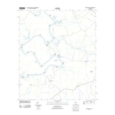
2011 Map of Woods Bluff
USGS Topo · Published 2011About this map
The Tombigbee River snakes through this landscape, defining a region where river transport once dictated the pace of life. Numerous named landings, bars, and shoals like Barneys Shoals, Cade Bar, and Grangers Bar underscore the historical importance of river navigation and commerce. The settlement of Woods Bluff sits near the Woods Bluff Shoal, while small rural communities like Rock Springs, Slater, and Failetown are connected by narrow county roads. In the southern portion of the map, Hatchet Cemetery and the settlement of Cunningham offer specific points of interest for genealogists tracing family roots in this corner of Alabama. The geography is heavily influenced by the drainage patterns of Bashi Creek, Turkey Creek, and Harris Creek, which cut through the terrain toward the main river channel.
Find a feature on this map
51 named features on this map. Tap any name to fly to it.
Don’t see what you’re looking for? This feature index may not catch every label — zoom into the map to look around manually.
Map Details
Editions of this 2011 Woods Bluff Map
This is the sole edition of this map. No revisions or reprints were ever made.
Other maps of this area

1953 · Montgomery
USGS Topo · 1:250,000

1953 · Andalusia
USGS Topo · 1:250,000

1953 · Hattiesburg
USGS Topo · 1:250,000

1953 · Meridian
USGS Topo · 1:250,000

1956 · Montgomery
USGS Topo · 1:250,000

1957 · Meridian
USGS Topo · 1:250,000

1957 · Montgomery
USGS Topo · 1:250,000

1957 · Andalusia
USGS Topo · 1:250,000

1958 · Hattiesburg
USGS Topo · 1:250,000

1965 · Meridian
USGS Topo · 1:250,000