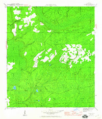
1945 Map of Woods
USGS Topo · Published 1960About this map
The Apalachicola National Forest dominates this landscape in Liberty County, revealing a complex network of wetlands and small watercourses mapped just before the end of World War II. The settlement of Woods serves as a lone residential anchor in the northwest, while the rest of the terrain is defined by its hydrologic character. Low-lying areas are identified by numerous bays—depressions or swampy areas—including Soldier Bay, Washington Bay, and Buggar Bay. These wetlands often transition into the dense Juniper Swamp or open up at Memory Island and Sheep Island.
Find a feature on this map
32 named features on this map. Tap any name to fly to it.
Don’t see what you’re looking for? This feature index may not catch every label — zoom into the map to look around manually.
Map Details
Editions of this 1945 Woods Map
4 editions found
Other maps of this area

1944 · Queens Bay
USGS Topo · 1:24,000

1945 · Blountstown
USGS Topo · 1:31,680

1945 · Hosford
USGS Topo · 1:31,680

1945 · Estiffanulga
USGS Topo · 1:31,680

1945 · Orange
USGS Topo · 1:31,680

1945 · Bristol
USGS Topo · 1:31,680

1945 · Woods
USGS Topo · 1:31,680

1945 · Telogia
USGS Topo · 1:24,000

1946 · Queens Bay
USGS Topo · 1:31,680

1946 · Telogia
USGS Topo · 1:31,680