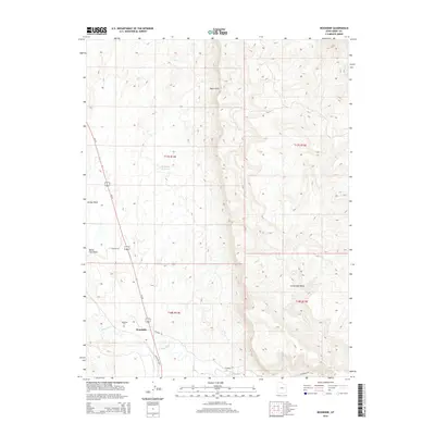
2014 Map of Woodside
USGS Topo · Published 2014About this map
Woodside sits at the foot of the massive Book Cliffs, where the Price River cuts through the desert landscape of eastern Utah. This 2014 survey captures a locality defined by its relationship with water and transportation, centered on the junction of Us-191 and S Woodside Hwy. For genealogists and local historians, the Woodside Cem provides a tangible link to the families who established this high-desert outpost. The drainage patterns of Marsh Flat Wash and Grassy Wash illustrate the complex topography of the region, while the Kiahtipes Reservoir and Little Park Wash point to the critical role of water management in this arid environment.
Find a feature on this map
16 named features on this map. Tap any name to fly to it.
Don’t see what you’re looking for? This feature index may not catch every label — zoom into the map to look around manually.
Map Details
Editions of this 2014 Woodside Map
This is the sole edition of this map. No revisions or reprints were ever made.
Other maps of this area

1886 · Price River
USGS Topo · 1:250,000

1896 · Price River
USGS Topo · 1:250,000

1948 · Woodside
USGS Topo · 1:62,500

1949 · Woodside
USGS Topo · 1:62,500

1950 · Woodside
USGS Topo · 1:62,500

1954 · Range Creek
USGS Topo · 1:62,500

1956 · Price
USGS Topo · 1:250,000

1960 · Price
USGS Topo · 1:250,000

1962 · Price
USGS Topo · 1:250,000
1963 · Gunnison Butte
USGS Topo · 1:62,500