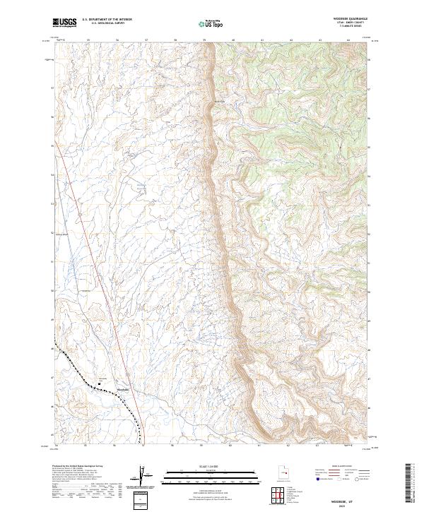
2023 Map of Woodside
USGS Topo · Published 2023About this map
Woodside is the central feature of this Emery County landscape, situated along the banks of the Price River. This small settlement, a historic stop for travelers in eastern Utah, is anchored by the Woodside Cem located just to the northwest. The terrain is defined by the striking rise of the Book Cliffs which dominate the eastern half of the map, creating a dramatic vertical transition from the river valley. Water management in this arid environment is evidenced by the Kiahitipes Reservoir and drainage systems like Grassy Wash. Transport through this corridor relies on local routes such as Co Rd 128, which provides access through the high-desert scrub and toward the base of the cliffs. The map illustrates a sparse but persistent human presence in a territory largely shaped by the erosive forces of the river and the massive geological formations of the cliffs.
Find a feature on this map
8 named features on this map. Tap any name to fly to it.
Don’t see what you’re looking for? This feature index may not catch every label — zoom into the map to look around manually.
Map Details
Editions of this 2023 Woodside Map
This is the sole edition of this map. No revisions or reprints were ever made.
Other maps of this area

1886 · Price River
USGS Topo · 1:250,000

1896 · Price River
USGS Topo · 1:250,000

1948 · Woodside
USGS Topo · 1:62,500

1949 · Woodside
USGS Topo · 1:62,500

1950 · Woodside
USGS Topo · 1:62,500

1954 · Range Creek
USGS Topo · 1:62,500

1956 · Price
USGS Topo · 1:250,000

1960 · Price
USGS Topo · 1:250,000

1962 · Price
USGS Topo · 1:250,000
1963 · Gunnison Butte
USGS Topo · 1:62,500