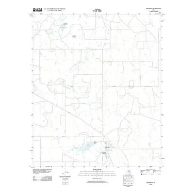
2010 Map of Woodson
USGS Topo · Published 2010About this map
The town of Woodson serves as the central hub of this Throckmorton County landscape, situated at the intersection of several regional routes. This ranching and agricultural region is defined by its water management systems, including Lake Woodson and Hugh Dickie Lake, which provide critical reservoirs for the surrounding area. To the north, the terrain rises toward Hay Rick Mountain, a prominent landmark overlooking the drainage of Bush Knob Creek. The map details an extensive network of rural roads such as Bush Knob RD and Stubblefield RD, reflecting the low-density settlement patterns and family-named landholdings typical of the Texas Rolling Plains. Small-scale impoundments like McKnight Lake further illustrate the localized efforts to secure water in this semi-arid environment, where Kings Creek and its branches like Middle Kings Creek carve winding paths through the territory.
Find a feature on this map
29 named features on this map. Tap any name to fly to it.
Don’t see what you’re looking for? This feature index may not catch every label — zoom into the map to look around manually.
Map Details
Editions of this 2010 Woodson Map
This is the sole edition of this map. No revisions or reprints were ever made.
Other maps of this area

1890 · Breckenridge
USGS Topo · 1:125,000

1892 · Albany
USGS Topo · 1:125,000

1893 · Albany
USGS Topo · 1:125,000

1954 · Abilene
USGS Topo · 1:250,000

1954 · Wichita Falls
USGS Topo · 1:250,000

1958 · Wichita Falls
USGS Topo · 1:250,000

1958 · Abilene
USGS Topo · 1:250,000

1965 · Lusk
USGS Topo · 1:24,000

1965 · Fort Griffin
USGS Topo · 1:24,000

1965 · Throckmorton NE
USGS Topo · 1:24,000