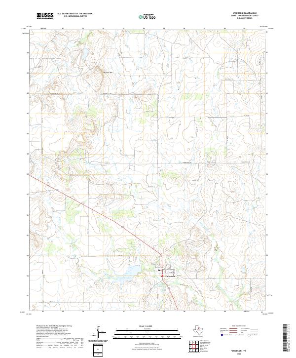
2022 Map of Woodson
USGS Topo · Published 2022About this map
Woodson serves as the central hub of this Throckmorton County landscape, where several rural routes and farm-to-market roads converge. The settlement is oriented around Church St and Oak St, with the nearby Woodson Cem providing a clear point of interest for those researching local family histories. The surrounding terrain is defined by the drainage systems of Kings Creek and Middle Kings Cr, which feed into local water bodies including Lake Woodson and Hugh Dickie Lake. To the north, the prominent elevation of Hay Rick Mtn rises above the cattle country and brushlands. The map details a network of family-named ranch roads like Davis Ranch Rd and Stubblefield Rd, which reflect the long-standing agricultural and ranching patterns of north-central Texas.
Find a feature on this map
35 named features on this map. Tap any name to fly to it.
Don’t see what you’re looking for? This feature index may not catch every label — zoom into the map to look around manually.
Map Details
Editions of this 2022 Woodson Map
This is the sole edition of this map. No revisions or reprints were ever made.
Other maps of this area

1890 · Breckenridge
USGS Topo · 1:125,000

1892 · Albany
USGS Topo · 1:125,000

1893 · Albany
USGS Topo · 1:125,000

1954 · Abilene
USGS Topo · 1:250,000

1954 · Wichita Falls
USGS Topo · 1:250,000

1958 · Wichita Falls
USGS Topo · 1:250,000

1958 · Abilene
USGS Topo · 1:250,000

1965 · Lusk
USGS Topo · 1:24,000

1965 · Fort Griffin
USGS Topo · 1:24,000

1965 · Throckmorton NE
USGS Topo · 1:24,000