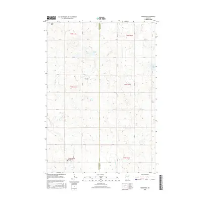
2016 Map of Woodstock
USGS Topo · Published 2016About this map
Woodstock occupies the southwestern corner of this survey, serving as the primary hub for the surrounding agricultural prairie at the border of Pipestone and Murray Counties. The landscape is dominated by the Coteau des Prairies, a vast upland plateau that influences the local drainage patterns. Significant water features including Engbarth Slough and Klinker Slough dot the northern half of the quadrangle, while the headwaters of the E Br Rock River and Beaver Cr carve subtle paths through the grid of township and range lines.
Find a feature on this map
36 named features on this map. Tap any name to fly to it.
Don’t see what you’re looking for? This feature index may not catch every label — zoom into the map to look around manually.
Map Details
Editions of this 2016 Woodstock Map
This is the sole edition of this map. No revisions or reprints were ever made.
Other maps of this area

1953 · Watertown
USGS Topo · 1:250,000

1953 · New Ulm
USGS Topo · 1:250,000

1954 · Fairmont
USGS Topo · 1:250,000

1955 · Sioux Falls
USGS Topo · 1:250,000

1957 · New Ulm
USGS Topo · 1:250,000

1958 · New Ulm
USGS Topo · 1:250,000

1958 · Sioux Falls
USGS Topo · 1:250,000

1958 · Fairmont
USGS Topo · 1:250,000

1958 · Watertown
USGS Topo · 1:250,000

1967 · New Ulm
USGS Topo · 1:250,000