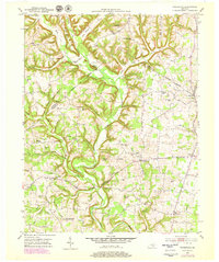
1952 Map of Woodstock
USGS Topo · Published 1979About this map
Buck Creek carves a winding path through this corner of the Commonwealth, defining the boundary-heavy landscape where Pulaski, Lincoln, and Rockcastle counties converge. The terrain is characterized by deep ravines like Bear Den Hollow and Osborne Hollow, separated by prominent ridges such as Buck Ridge and Harness Ridge. Local life in the early 1950s was centered around several rural hubs, including Woodstock, Bee Lick, and Goochtown. This map reveals a high density of rural institutions that often served as the social fabric for these ridge-top communities.
Find a feature on this map
67 named features on this map. Tap any name to fly to it.
Don’t see what you’re looking for? This feature index may not catch every label — zoom into the map to look around manually.
Map Details
Editions of this 1952 Woodstock Map
2 editions found
Other maps of this area

1893 · London
USGS Topo · 1:125,000

1897 · London
USGS Topo · 1:125,000

1935 · Somerset
USGS Topo · 1:62,500

1952 · Halls Gap
USGS Topo · 1:24,000

1952 · Eubank
USGS Topo · 1:24,000

1952 · Crab Orchard
USGS Topo · 1:24,000

1952 · Shopville
USGS Topo · 1:24,000

1952 · Woodstock
USGS Topo · 1:24,000

1953 · Maretburg
USGS Topo · 1:24,000
1953 · Brodhead
USGS Topo · 1:24,000