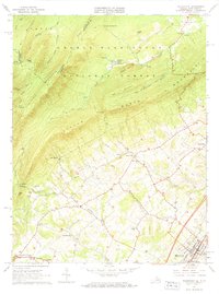
1966 Map of Woodstock
USGS Topo · Published 1968About this map
Woodstock serves as the valley anchor for this mid-century survey, where the Southern railroad line runs parallel to the winding Pughs Run. To the west, the landscape rises sharply into the ridges of the George Washington National Forest, defined by the parallel crests of Little North Mountain and Capon Mountain. The industrial heritage of the Shenandoah Valley is evident in the remains of the iron industry at Columbia Furnace and the Van Buren Furnace (Ruins) located near Sulphur Springs Gap. These sites, along with small crossroads like Alonzaville and St Luke, reflect a transition from 19th-century resource extraction to a rural agricultural and educational landscape, exemplified by the Massanutten Military Academy on the edge of the county seat. The map also detail numerous small churches and family-named hollows, including Patmos Ch and Racer Camp Hollow, providing a detailed record of local settlement patterns.
Find a feature on this map
51 named features on this map. Tap any name to fly to it.
Don’t see what you’re looking for? This feature index may not catch every label — zoom into the map to look around manually.
Map Details
Editions of this 1966 Woodstock Map
2 editions found
Other maps of this area

1891 · Romney
USGS Topo · 1:125,000

1892 · Woodstock
USGS Topo · 1:125,000

1893 · Luray
USGS Topo · 1:125,000

1894 · Winchester
USGS Topo · 1:125,000

1905 · Luray
USGS Topo · 1:125,000

1922 · Wardensville
USGS Topo · 1:62,500

1923 · Middletown
USGS Topo · 1:62,500

1923 · Edinburg
USGS Topo · 1:62,500

1924 · Wardensville
USGS Topo · 1:62,500

1937 · Middletown
USGS Topo · 1:48,000