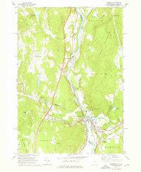
1973 Map of Woodsville
USGS Topo · Published 1976About this map
Woodsville and Wells River serve as the focal point of this survey, marking the confluence where the Ammonoosuc River and the Wells River meet the Connecticut River. This riverine crossroads is defined by its industrial and transport infrastructure, including the convergence of the Canadian Pacific and Boston and Maine railroads. The map highlights the social fabric of these valley communities, documenting local landmarks like the Cottage Hospital, a Drive-in Theater, and the Blue Mtn Union Sch.
Find a feature on this map
52 named features on this map. Tap any name to fly to it.
Don’t see what you’re looking for? This feature index may not catch every label — zoom into the map to look around manually.
Map Details
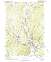
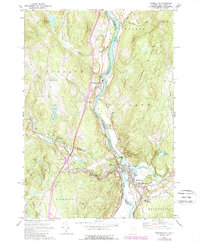
Editions of this 1973 Woodsville Map
3 editions found
Other maps of this area

1929 · Moosilauke
USGS Topo · 1:62,500

1931 · Littleton
USGS Topo · 1:62,500

1931 · Woodsville
USGS Topo · 1:48,000

1932 · Littleton
USGS Topo · 1:48,000

1932 · Moosilauke
USGS Topo · 1:62,500

1935 · Woodsville
USGS Topo · 1:62,500

1935 · Littleton
USGS Topo · 1:62,500

1938 · St. Johnsbury
USGS Topo · 1:48,000

1941 · Woodsville
USGS Topo · 1:62,500

1943 · St. Johnsbury
USGS Topo · 1:62,500