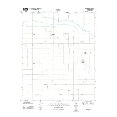
2012 Map of Woodville
USGS Topo · Published 2012About this map
Woodville and Poplar anchor this central San Joaquin Valley landscape, which is defined by a rigorous grid of section-line roads and the branching waterways of the Tule River system. The northern half of the map reveals the intricate drainage of the N Br Tule River, the Middle Br S Br Tule River, and the S Br Tule River, while the Tule River itself crosses the northeast corner near the Oettle Bridge. The settlement pattern follows established agriculture and ranching, evidenced by locations such as Schenley Ranch, Greenleaf Farms, and the intersection communities of Lairds Corner and Lowes Corner. In the northeast corner, the Harmony School serves the rural population near Harmony, illustrating the distributed nature of local community centers. The map provides a precise view of the irrigation and transport infrastructure essential to Tulare County's agricultural economy in the early 21st century.
Find a feature on this map
50 named features on this map. Tap any name to fly to it.
Don’t see what you’re looking for? This feature index may not catch every label — zoom into the map to look around manually.
Map Details
Editions of this 2012 Woodville Map
This is the sole edition of this map. No revisions or reprints were ever made.
Other maps of this area

1925 · Tulare
USGS Topo · 1:31,680

1925 · Tipton
USGS Topo · 1:31,680

1927 · Cairns Corner
USGS Topo · 1:31,680

1927 · Tulare
USGS Topo · 1:31,680

1928 · Tipton
USGS Topo · 1:31,680

1928 · Woodville
USGS Topo · 1:31,680

1928 · Lindsay
USGS Topo · 1:31,680

1929 · Sausalito School
USGS Topo · 1:31,680

1929 · Porterville
USGS Topo · 1:31,680

1929 · Pixley
USGS Topo · 1:31,680