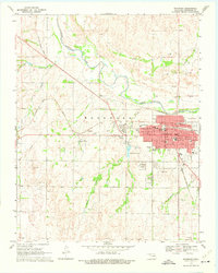
1969 Map of Woodward
USGS Topo · Published 1975About this map
The North Canadian River meanders through the northwest corner of this Oklahoma landscape, defining the topography near the settlement of Woodward. In the late 1960s, the area served as a vital transportation hub, marked by the junction of the Missouri - Kansas - Texas and the Atchison Topeka and Santa Fe railroads. An Old Railroad Grade sits near Gerlach, hinting at earlier transit patterns across the plains.
Find a feature on this map
36 named features on this map. Tap any name to fly to it.
Don’t see what you’re looking for? This feature index may not catch every label — zoom into the map to look around manually.
Map Details
Editions of this 1969 Woodward Map
2 editions found
Other maps of this area

1955 · Woodward
USGS Topo · 1:250,000

1958 · Woodward
USGS Topo · 1:250,000

1969 · Fargo
USGS Topo · 1:24,000

1969 · Woodward SW
USGS Topo · 1:24,000

1969 · Woodward
USGS Topo · 1:24,000

1969 · Sharon
USGS Topo · 1:24,000

1969 · Fargo SE
USGS Topo · 1:24,000

1969 · Woodward NE
USGS Topo · 1:24,000

1970 · Sleeping Bear Creek SW
USGS Topo · 1:24,000

1970 · Sleeping Bear Creek SE
USGS Topo · 1:24,000