
1983 Map of Woodworth Hill
USGS Topo · Published 1983About this map
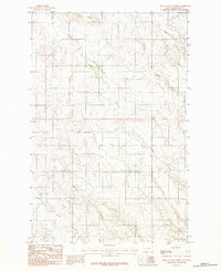
The Redwater River winds through the northwestern corner of this landscape, marking a terrain defined by extensive drainage systems along the border of McCone and Dawson counties. The central feature, Woodworth Hill, rises above a network of seasonal and perennial waterways including Cottonwood Creek and the southern reaches of Buffalo Springs Creek. This region reflects the sparse, ranch-oriented settlement patterns of eastern Montana in the late 1970s and early 1980s, where land use is dictated by the deeply eroded coulees and creek beds. A solitary Gravel Pit near the northern boundary provides a rare indication of local industry amidst the drainage basins of Stilson Coulee and Sioux Creek, which carve out the high-plains topography.
Find a feature on this map
11 named features on this map. Tap any name to fly to it.
Don’t see what you’re looking for? This feature index may not catch every label — zoom into the map to look around manually.
Map Details
Editions of this 1983 Woodworth Hill Map
This is the sole edition of this map. No revisions or reprints were ever made.
Other maps of this area

1954 · Glendive
USGS Topo · 1:250,000

1957 · Glendive
USGS Topo · 1:250,000

1958 · Glendive
USGS Topo · 1:250,000

1982 · Circle
USGS Topo · 1:100,000

1983 · Olson Coulee South
USGS Topo · 1:24,000

1983 · Mount Antelope
USGS Topo · 1:24,000

1983 · Quick Reservoir
USGS Topo · 1:24,000

1983 · Buffalo Creek
USGS Topo · 1:24,000

1983 · Circle
USGS Topo · 1:24,000
1983 · Olson Coulee North
USGS Topo · 1:24,000