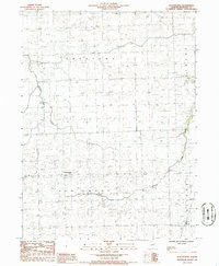
1986 Map of Woodworth
USGS Topo · Published 1986About this map
The agricultural landscape of Iroquois County is centered on small crossroads communities like Woodworth and Schwer in the mid-1980s. This survey, compiled from 1983 aerial photography, illustrates a highly organized grid of township boundaries including Ash Grove, Crescent, Belmont, and Milford. The terrain is defined by its subtle drainage patterns, where Shavetail Creek and Jefferson Creek meander through the flat prairie lands. Beyond the primary settlements, the map identifies specific landmarks like the Shave Tail area and a rural Landing Strip, alongside a high-altitude Radio Facility. Genealogists will find interest in the documented Cem and church locations that served these rural Illinois parishes, and the tiny hamlet of Bryce in the southeast corner. The map's layout reflects a classic Midwestern township system, showing the persistent rural character of the region before any significant modern expansion.
Find a feature on this map
16 named features on this map. Tap any name to fly to it.
Don’t see what you’re looking for? This feature index may not catch every label — zoom into the map to look around manually.
Map Details
Editions of this 1986 Woodworth Map
This is the sole edition of this map. No revisions or reprints were ever made.
Other maps of this area

1935 · Watseka
USGS Topo · 1:48,000

1938 · Milford
USGS Topo · 1:48,000

1939 · Watseka
USGS Topo · 1:62,500

1939 · Cissna Park
USGS Topo · 1:62,500

1944 · Milford
USGS Topo · 1:62,500

1944 · Gilman
USGS Topo · 1:62,500

1946 · Gilman
USGS Topo · 1:62,500

1949 · Cissna Park
USGS Topo · 1:62,500

1953 · Danville
USGS Topo · 1:250,000

1955 · Danville
USGS Topo · 1:250,000