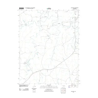
2012 Map of Woolaroc
USGS Topo · Published 2012About this map
The Osage Hills ranching country southwest of Bartlesville is anchored by Woolaroc, the preserve and museum estate established during the 1920s oil boom. This landscape is defined by its numerous natural water sources and small impoundments, including the classically named Ponce De Leon Spring, Nehawaski Spring, and Wim Wigor Spring. These springs and seasonal creeks like Sand Cr and Little Rock Cr feed several larger water bodies such as Crystal Lake, Clyde Lake, and Lake Higo. The terrain is marked by distinctive topographical features like Whisky Hollow and Buck Point. While the area remains largely rural and dominated by ranching and preservation, the map identifies small historic settlement points such as Fite and Torpedo, which serve as markers of the area's local geography alongside a network of county roads including Old HWY 123.
Find a feature on this map
71 named features on this map. Tap any name to fly to it.
Don’t see what you’re looking for? This feature index may not catch every label — zoom into the map to look around manually.
Map Details
Editions of this 2012 Woolaroc Map
This is the sole edition of this map. No revisions or reprints were ever made.
Other maps of this area

1901 · Nowata
USGS Topo · 1:125,000

1906 · Nelagoney
USGS Topo · 1:24,000

1909 · Pawhuska
USGS Topo · 1:125,000

1910 · Pawhuska
USGS Topo · 1:125,000

1914 · Nowata
USGS Topo · 1:125,000

1954 · Tulsa
USGS Topo · 1:250,000

1955 · Enid
USGS Topo · 1:250,000

1958 · Enid
USGS Topo · 1:250,000

1958 · Tulsa
USGS Topo · 1:250,000

1960 · Nelagoney
USGS Topo · 1:24,000