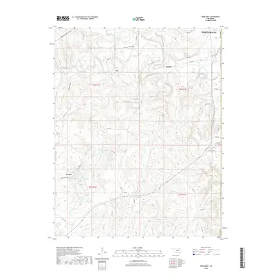
2018 Map of Woolaroc
USGS Topo · Published 2018About this map
Woolaroc defines the southwestern corner of this landscape, an area characterized by a high density of natural springs and small upland lakes. Named springs such as Nehawka Spring, Wim Wigor Spring, Daddy Miller Spring, and the Ponce De Leon Spring suggest a historically significant groundwater network that likely shaped early settlement and ranching patterns here. This hydrography feeds into several drainages, including Little Rock Cr and Sand Creek, which flow through the undulating terrain south of Bartlesville.
Find a feature on this map
68 named features on this map. Tap any name to fly to it.
Don’t see what you’re looking for? This feature index may not catch every label — zoom into the map to look around manually.
Map Details
Editions of this 2018 Woolaroc Map
This is the sole edition of this map. No revisions or reprints were ever made.
Other maps of this area

1901 · Nowata
USGS Topo · 1:125,000

1906 · Nelagoney
USGS Topo · 1:24,000

1909 · Pawhuska
USGS Topo · 1:125,000

1910 · Pawhuska
USGS Topo · 1:125,000

1914 · Nowata
USGS Topo · 1:125,000

1954 · Tulsa
USGS Topo · 1:250,000

1955 · Enid
USGS Topo · 1:250,000

1958 · Enid
USGS Topo · 1:250,000

1958 · Tulsa
USGS Topo · 1:250,000

1960 · Nelagoney
USGS Topo · 1:24,000